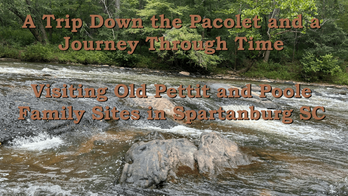
A Trip Down the Pacolet and a Journey Through Time: Visiting Pettit and Poole Family Sites in Spartanburg SC
The Plan: From Clifton to Pacolet Mills and All Pettit and Poole Points in Between
In September of 2025 my youngest son and I made a spur of the moment trip to our ancestral homeland in Spartanburg County, SC. Our plan was to navigate down the Pacolet River and camp under the stars on the land that once belonged to Henry Pettit and William Poole. We set out to explore the old Poole Springs (Healing Springs), Pettit Mill Branch, Tumbling Shoals, Lawsons Fork, and various other sites. We planned to exit the river the next evening at Pacolet Mills.
We secured permission from the property owner to camp at Poole Springs. We found a local who was willing to rent us some kayaks and a tent. We crammed what we thought were the minimum camping supplies into our carry-on bags and flew from Oklahoma to the Greenville/Spartanburg airport. In Spartanburg we met the outfitters who dropped us off, along with two kayaks, on the east side of the Pacolet River just below the dam at Clifton. We didn’t really have any idea what we were getting ourselves into but were ready for some adventure.
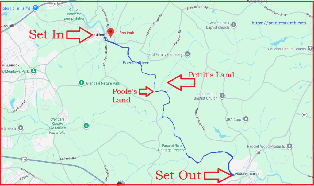
The course down the Pacolet River we followed on our two-day excursion. Click to open location in Google Maps.
Beginning at Clifton Dam
After setting in we paddled upstream to the dam. Since neither of us had any experience kayaking a river this helped us to get a feel for it and understand the current which was fairly gentle in this area. From the dam we turned around and embarked on our journey downstream.
No sooner than we started, the sky behind us darkened. An ominous thunderstorm had formed over the mountains to the west and was threatening to overtake us. We were alone on the river with no shelter so our only option was to keep moving. As we hurried along, the storm passed around us on the north without causing us harm. Good weather and sunny skies opened up before us.
The water level on the Pacolet this day was just about perfect. It was deep enough that no portage was necessary but shallow enough that some of the shoals offered some pretty exciting rapids to navigate. We tumbled through and had so much fun that we paddled back up and went through them a few more times. Most of the Pacolet shoals are deemed Class I rapids but one was a Class II. That one was our favorite. The image below shows the third shoal we encountered just before reaching Quinn Branch.
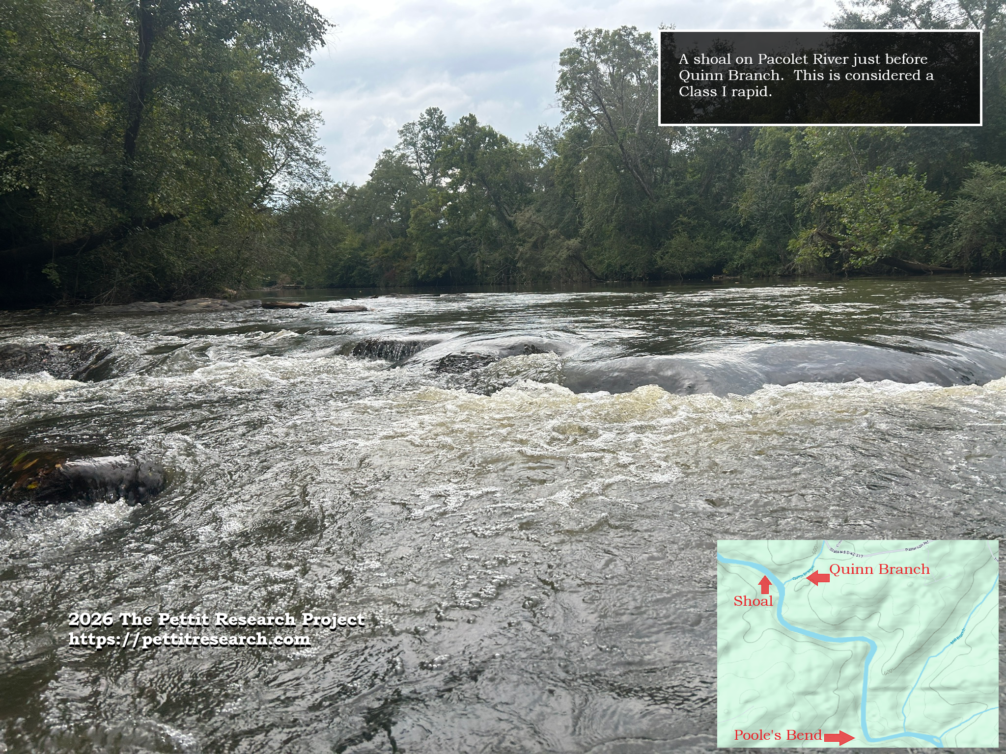
A shoal on Pacolet River before Quinn Branch.
Quinn Branch of the Pacolet
Just past these rapids on the north side of the river, we located Quinn Branch. It is not certain when the branch became known as Quinn Branch. It appears a portion of the land closer to the river through which it flows belongs to the Quinn family. Their ancestry can be traced to James Washington Quinn, born March 28, 1832. He lived in the area and is buried nearby in Bethesda Baptist Church cemetery. (This church is also where grave markers for William Poole and his wife Elizabeth can be found.)

Quinn Branch of Pacolet River
Quinn Branch empties into the Pacolet River on the north side. It has a constant flow of clear running water and is fed by at least one spring. This spring is just over a mile from the river off of Crocker Rd. Today this spring belongs to a member of the Pettit family who is a descendant of Joshua Pettit and Judith Poole though John G. “Jack” Pettit. Jack Pettit, his wife and son were the first Pettits my family and I met in the Spartanburg/Cowpens area when we first visited. I was the teenage boy back then. While on a family vacation there in the 1990s they took us through the woods to see the old Pettit cemetery.
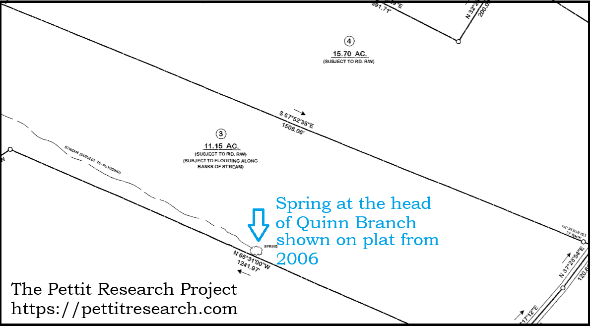
Modern plat showing the location of the spring that feeds Quinn Branch.
Moving further down river we encountered more turbulent shoals. The wildest was just before entering a bend in the river. Old land records for the area refer to this area as the Tumbling Shoals. This was one of the western borders of Henry Pettit’s land for a time.
Coming into a sharp turn in the river we knew we were approaching Poole’s Bend and the location of Poole’s Spring which would be our campsite for the night. We spotted the clear spring-fed stream entering on the west side of the river. We pulled our kayaks up the steep riverbank and eagerly made our way to the spring.
Poole Springs
Early South Carolina land grants indicate Poole Spring was originally known as the “Healing Springs”. It has also been called Pacolet Springs and Pacolet Mineral Springs. William Poole was granted 23 acres that included “half the Healing Springs” in 1795. A road was shown crossing Poole’s land to the spring and as early as 1795 a graveyard to the north of the spring already noted the location of “John George’s old grave.” It is very possible this old cemetery was obliterated when the natural gas pipeline was installed that now spans the area to the north.
Henry Pettit, whose primary land holdings and personal residence were on the opposite side of the river, sold a portion of his land on the south side to William Poole in January of 1793. This land butted up to the spring tract. William Poole would later be identified in some records as “William Poole of Healing Springs” and a “trusty friend” of Charleston businessman Abraham Markley. Poole raised a large family here, including two daughters who married into the Pettit family. Anna Poole married Henry Pettit and Judith Poole married his brother Joshua Pettit. In later years a hotel would be built by the Poole family to serve visitors. Many would come to dip in the cool waters in hopes of curing their various ailments.
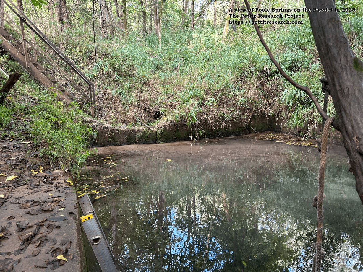
A view of Poole’s Spring on the Pacolet River in 2025.
What was surprising was that most of the geographic features mentioned in old plats and deeds from the late 1700s and early 1800s were still present. The flood of 1903 that sent a “wall of water” crashing down the river should have dramatically changed the landscape. While it did erase several industrial mill sites from the map, many of the natural river features survived. Several shoals and small islands were right there where they always had been. That being said, Poole Springs was not so fortunate. The deluge of 1903 destroyed the hotel and entombed the springs in mud.
Thankfully, the story did not end there. When excavation occurred for the pipeline right of way nearby, the Poole family had the springs dug out and restored. Today the springs are protected on all sides by concrete walls. The water flows through a small gate in the east wall and meanders a short distance down into the Pacolet River.

View of the gate in the concrete wall around Poole Springs.
A rusty old staircase provides access to the spring where cold water bubbles up through the sparkling floor. Small gold-colored flakes emerge, interspersed among the differing hues of brown. Spring water gushes through what looks like 10 -12 miniature sand “volcanoes” on the bottom. The sand has an unusual blue tinge at the exact point at which the water emerges. Tiny fish dart around enjoying the peacefulness of the calm water –a sanctuary for them, and us, compared to the murky rolling Pacolet.
We descended the stairs and submerged ourselves in the old spring. It was cold enough to make one’s teeth chatter. Despite the cold, we dipped ourselves under water seven times just to make sure we were healed up good and proper.
David Poole, a direct descendant of William Poole and current owner of the land, was kind enough to give us access and have an area brushogged around the springs for our visit. We surveyed the area and set up our tent on the edge of the forest. We had enough daylight left that we decided to go back down to the river and kayak back up to the shoals to play around a bit.
A Night at Healing Springs Hotel
As night drew near it began to sprinkle. We made our way back to the campsite. Somewhere in this vicinity the Poole Springs Hotel once stood, providing warmth and rest for weary travelers. This night, a little tent on a freshly cleared field would meet our needs just fine. We gathered a small collection of firewood under a tarp which we would need for the morning meal. When night fell, the sprinkles turned to rain.
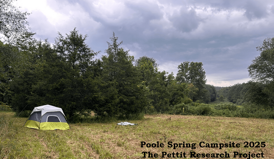
Huddled in the somewhat leaky tent with a couple of pocket-sized flashlights, we recapped our adventures of the day, read a few pages from God’s Word and went to bed. It was a surprisingly quiet night. As I lay there, I thought to myself, “how fortunate we are…”
Observing my son who was instantly asleep without a care in the world, I pondered the tumultuous events that gripped this place 250 years ago. Henry Pettit, our ancestor, would have been about the same age as my boy –13 years old. When many families were massacred by the Cherokee a few miles to the west, young Henry had to pick up his musket and go to war. His mother and several siblings took refuge in a fort built by his father so that they would not suffer the same fate as their poor neighbors. Henry, my 5th great grandfather, moved in and out of these woods and across this river hunting men and being hunted by men “as for the deer in the woods”. To volunteer to engage in a protracted life and death struggle at the age of 13 seems unfathomable today.
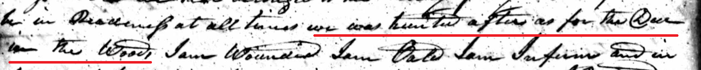
“We was hunted after as for the deer in the woods…” Henry Pettit’s testimony about his Revolutionary War service.
“The hunt” was almost over for young Henry in 1781 when he was wounded at the battle of Cowpens. But he recovered, reenlisted, and, with his help, the new nation eventually prevailed. After the war, he returned home to the Pacolet, got married, and began purchasing land. Among his several acquisitions was a tract on the south side of the Pacolet adjoining his father-in-law William Poole and next to this spring tract where we were encamped. No doubt Pettit and Poole roamed through this very same field well over two centuries ago. They couldn’t have known their descendants would be coming to visit but somehow I still still felt welcome.
The rain let up. A hoot owl perched in the darkness nearby called out to see who we were and to let me know it was getting late. His ancestors probably lived here too –probably long before mine. I ceded the night watch to my wise feathered friend and joined my son in peaceful slumber.
In the morning we cooked some breakfast on the campfire, took another dip in the spring and packed up, leaving no traces we were there. The weather was perfect.
We said goodbye to the springs and shoved off for our next destination: Mill Branch.
We did not have to travel far to find it.
Mill Branch of the Pacolet
Mill Branch is a beautiful little brook that winds through the surrounding woods with a continuous flow of clear water. It was by far the largest creek we encountered before we reached Lawson’s Fork. It is down river from Poole’s Spring a short distance and on the opposite side. The modern name “Mill Branch” probably gets its name from this mill that the Pettit family operated there as it was also called “Pettit’s Branch” in some deeds.
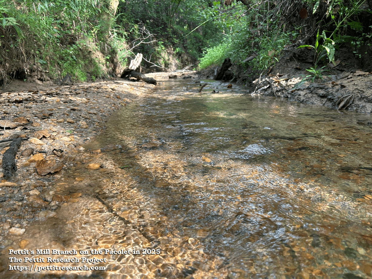
Pettit’s Mill Branch on the Pacolet River in 2025.
The first name for this stream appears to be “Graham’s Branch” which was likely named after Arthur Graham. Graham had land grants in the area along the Pacolet as early as 1771. Many of these were granted by North Carolina but when the Carolina boundary line was decided the land was determined to be in South Carolina. In 1788 a Joshua Pettit and John Hembree obtained a warrant for 640 acres that included the mouth of this branch and much of the headwaters. This Joshua Pettit was most likely Henry’s brother. Their father Joshua Pettit Sr is thought to have been deceased by this date. For reasons not known, Pettit and Hembree let the warrant elapse and did not take ownership of the land. When it was available to the public again, a man named John Gray swooped in to claim it.
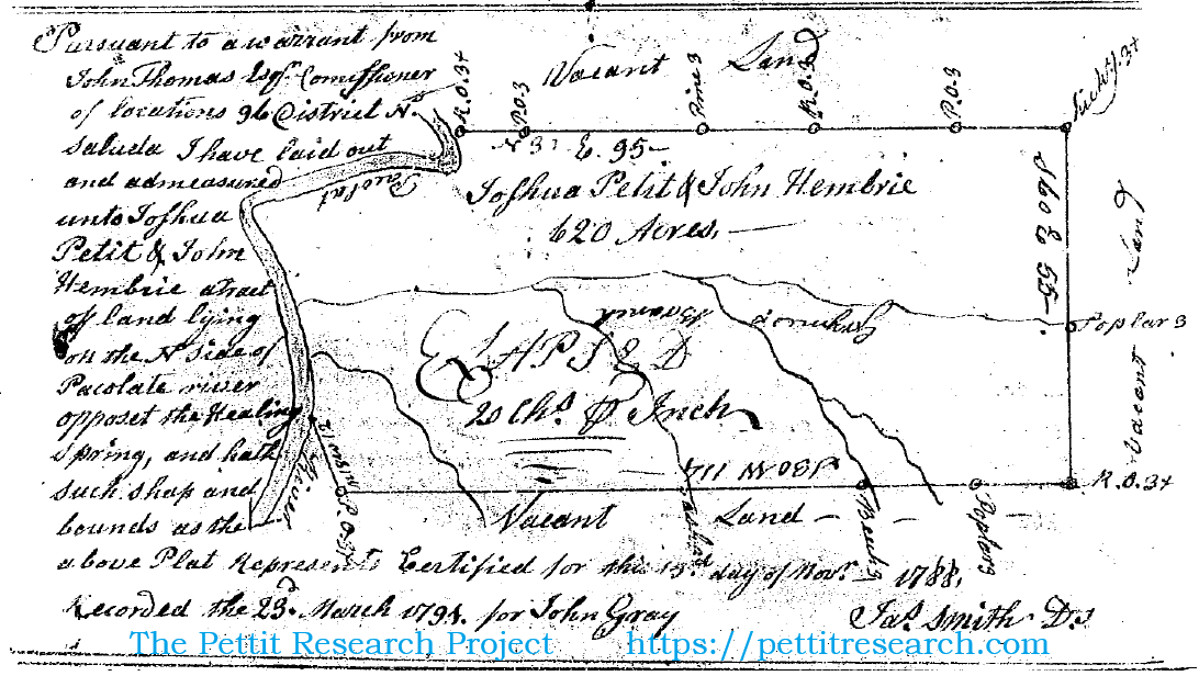
“Grahams Branch” surveyed for Joshua Pettit and John Hembree in 1788. This would later be called “Pettit’s Branch” and eventually “Mill Branch”.
John Gray sold half of this land to Henry Pettit in September of 1793. Henry sold 150 acres of his 300-acre tract to Christopher Scaggs in February of 1798 and the other 150 to his brother Joshua Pettit in March of 1801. Henry Pettit removed to Rutherford County, NC. Joshua Pettit assumed full ownership of the site and operated the mill on this branch for many years. Several mills are listed in the 1825 Mill’s Atlas of Spartanburg County. Patterson’s Spring and the Poole’s house are shown but Pettit’s mill is not.
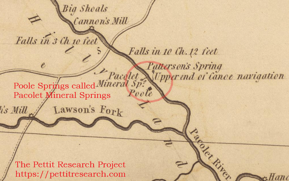
1825 Mills’ Atlas of Pacolet River area showing Pacolet Mineral Springs and the location of the Poole house.
Despite being absent from the 1825 atlas, we know it was still operational in 1826 when it was mentioned in Joshua Pettit’s will. Joshua tasked his son John Pettit with keeping up the mill in exchange for 1/3 of the income. The other 2/3 was supposed to be for the support of the widow, Judith. It would seem John Pettit had other aspirations. He left for Benton Co., AL sometime before the 1840 census. Around this time, the mill, if it was still functioning, most likely came into the possession of his brother William P. Pettit.
Joshua Pettit Jr died on May 29, 1827, and was laid to rest in the Pettit cemetery. His wife Judith Poole would eventually come to rest beside him as would his son William P. Pettit. This cemetery is about a mile and half up Mill Branch from where it enters the Pacolet. This land belonged to the Pettit family until the late 20th century when much of it was subdivided and sold.
Lawsons Fork
After departing Mill Branch we continued down the Pacolet taking note of more shoals and a couple of small islands. It was about a mile down river from Poole’s Spring where we encountered Lawsons Fork Creek.
At one time William Poole owned the land from the springs all the way down to Lawsons Fork and beyond. In his deposition for his Revolutionary War pension application, Henry Pettit stated that the Pettits were living on Lawsons Fork in 1776. Col William Wofford operated an Iron Works on this creek near present-day Glendale. Henry’s father Joshua appears to have been associated with Wofford in some way. He witnessed deeds between Wofford and patriot John Nucklos, served under him in the revolution, and lived nearby, possibly on Wofford’s land.
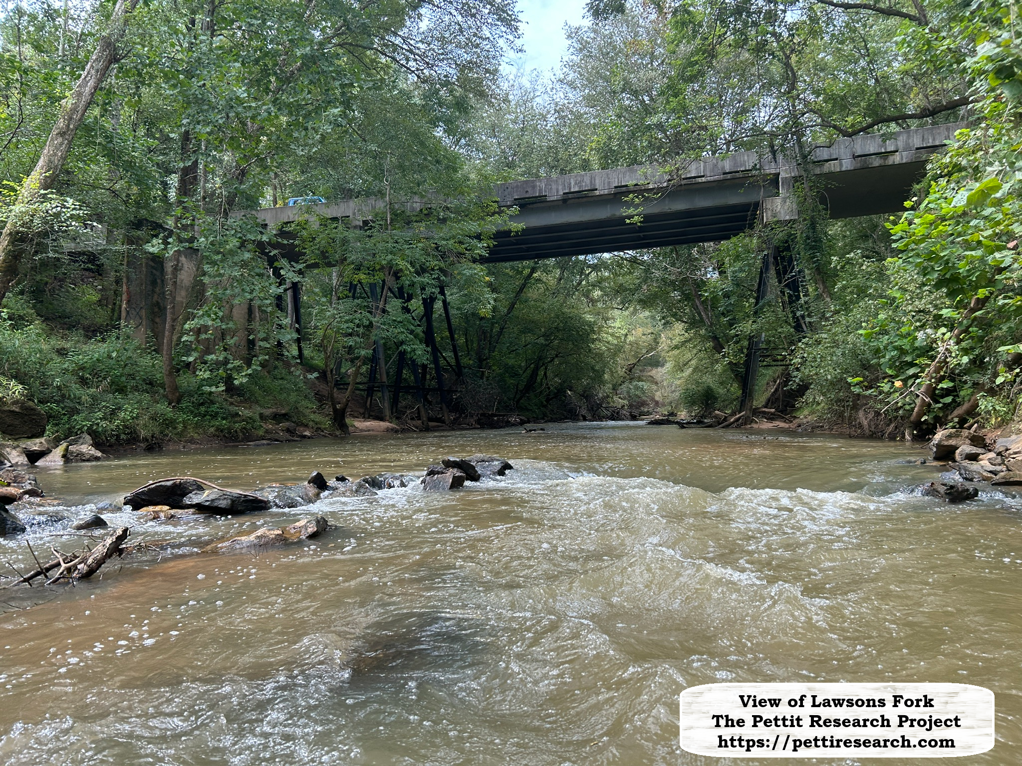
A view of Lawsons Fork.
We paddled up Lawsons Fork to the Goldmine Road bridge. The water was swift, shallow and there was a number of logs and rocks that impeded the course. At the bridge we turned around and paddled back to the Pacolet.
Across from the mouth of the creek on the Pacolet there is a large island of interest. It is at least 300′ long and covered in trees.
Just south of where Lawsons Fork enters the Pacolet, rock bluffs tower overhead and force the stubborn river to bend its course. As the waters of Lawsons Fork merged with those of the Pacolet, the river widened and our pace slowed considerably.
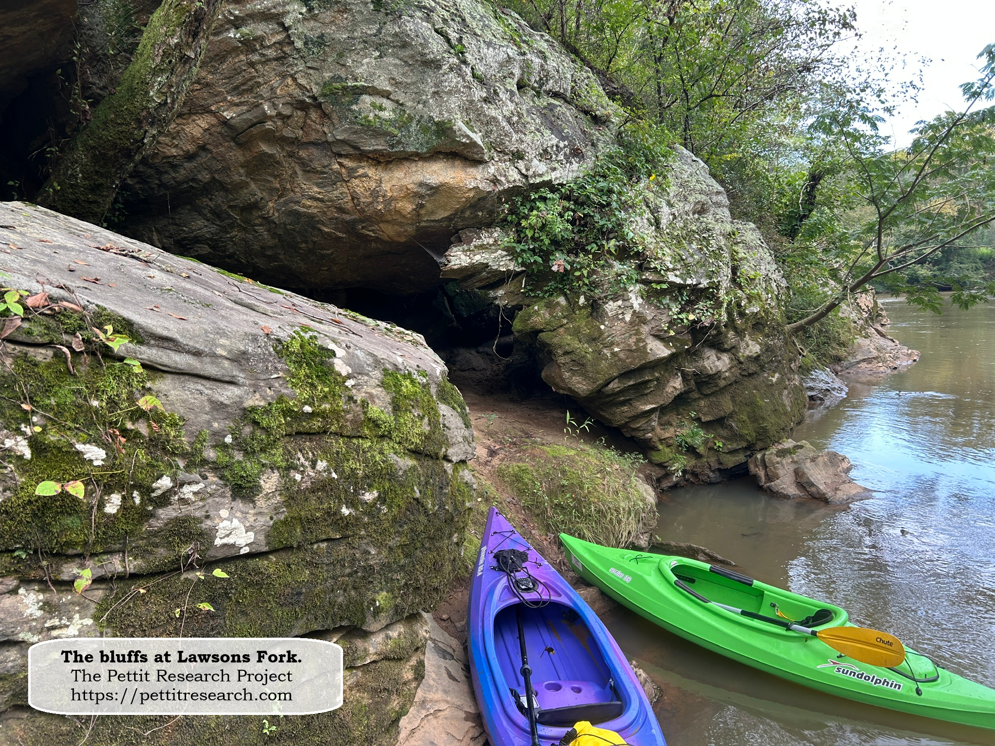
The bluffs and a small cave where Lawsons Fork meets the Pacolet River.
We continued our course down river, stopping to inspect several other interesting features. The sight of Richland Creek was a bit of a surprise. I had only studied it on maps, plats, and deeds and envisioned a creek of similar size to Lawsons Fork. In reality Richland Creek was less than spectacular. It was smaller in size than even Mill Branch. It was also quite muddy.
We eventually reached the signs warning us of the dam at Pacolet Mills. At the dam we exited the river and contacted our outfitters to come pick us up. Before we departed we took a peek at the old amphitheater at Pacolet Mills.
Trips’ End
We traveled back to Greenville where we met South Carolina cousin and gracious local guide Jeff Pettit. Jeff is a great guy with a love of family history. He was kind enough to show us around Greenville and the area where Richard Pearis’ White Plains plantation once stood. That evening we had dinner with Jeff Pettit, author, genealogist and historian Larry Voreis and his wife Suzanne, and Director of Marketing and Tourism for the City of Gaffney, LeighAnn Moon and her husband Ken. LeighAnn is also a Pettit cousin. As one could imagine with a group like this, we nerded out on history well into the evening.
The next day my son and I returned to Oklahoma. We were a little tired and maybe had a few too many chigger bites but we sure had some good stories to tell.
Concluding Remarks
The allure of genealogy is that it allows one to study history in a way that is deeply personal. It is not just a land deed; it is your ancestor’s home. It is not just a war; it is your grandfather’s war. It is not just history; it is your history. This kayaking and camping excursion would have been a memorable one in its own right. However, overlaying our family’s history on top of this little adventure made it much more than a trip down the Pacolet River. For us it was a journey through time.
January 15, 2026
Brandon Pettit
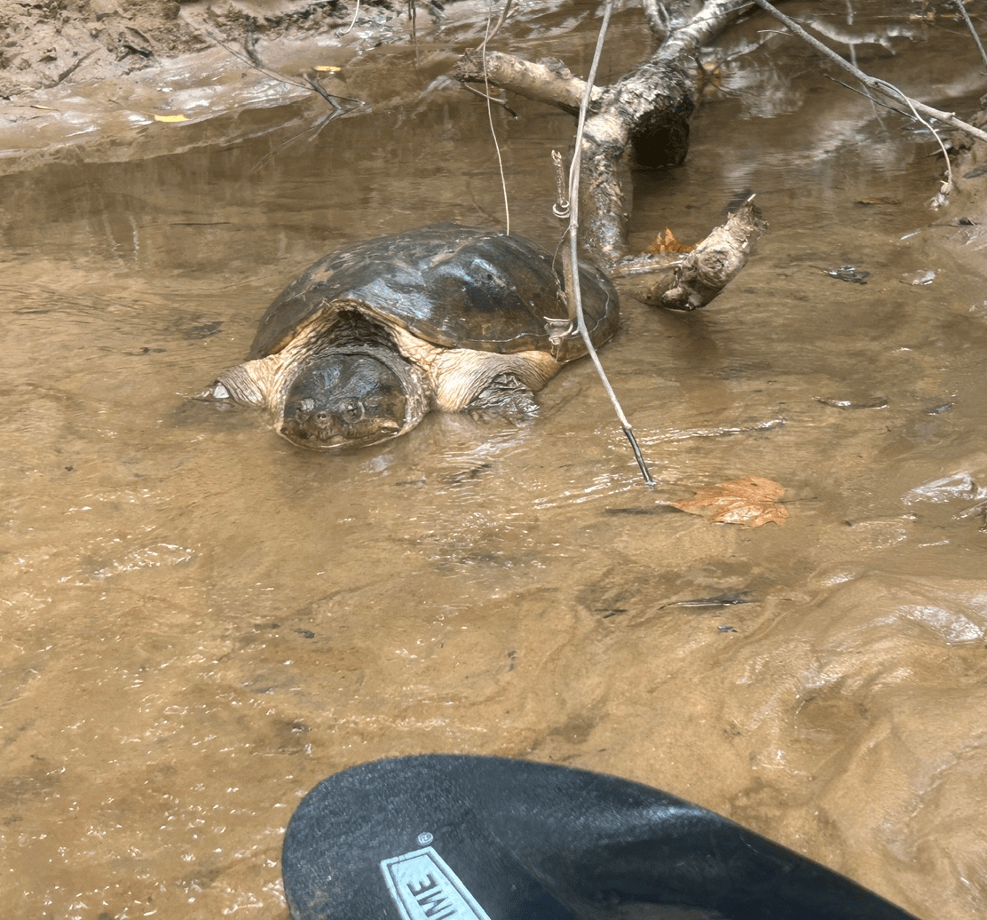
Though we enjoyed our trip down the Pacolet, the resident turtle was not amused by our presence.